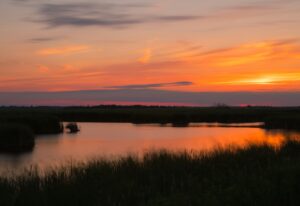
Murrells Inlet has roughly 16.5 miles of tidal creeks and thirteen public launch sites between Surfside Beach and Georgetown. What it doesn’t have is a straight answer to the question people actually ask standing at the ramp with a rented boat: okay, I’m in the water — now where do I go?
That’s what this is. Five routes, ordered easiest to hardest, each with the distance, the realistic time on the water, the tide window that makes it work, and where you can get off if it stops being fun. Three of them are fine for a first-timer. One of them isn’t for you unless you already know why it isn’t.
Key takeaways
- The tide window matters more than the distance. A 2-mile creek route at the wrong tide stage is harder than a 5-mile route at the right one.
- Oyster Landing’s marsh loop is the best first route in the inlet — 112 free parking spaces, a courtesy dock to launch from, and you’re never far from the ramp.
- Alston Creek from the Morse Park hand launch is the prettiest morning paddle here, and the least forgiving. It drains to mud. Miss your window and you’re walking.
- Wacca Wache is the odd one out — blackwater river, cypress and Spanish moss, no marsh grass at all. It’s the route to save for a windy day.
- The jetty run is a real trip, not a rental-shop afternoon. If you’ve never read current at an inlet mouth, go with a guide the first time.
- Distances below are approximate. Creek routes wander, and the line you actually paddle is never the line on the map.
How to read the tide windows
Every route below lists a tide window written like this: HW−2 to HW+2. That means launch no earlier than two hours before high water and be heading back by two hours after.
Murrells Inlet is a tidal estuary, not a lake. The water rises and falls about twice a day and the current reverses with it, which means the same creek is a different creek six hours later. Some of these routes have a four-hour window. One has a three-hour window and no flexibility at all.
Before you commit to any of them, pull the day’s chart from our tides page and read Best Time to Kayak Murrells Inlet if you haven’t already — it covers why the incoming tide is usually your friend and why afternoons in summer are a gamble.
One more thing before the routes: read Is Murrells Inlet Safe to Kayak? The short version is that the current and the boat traffic are what get people, not the alligators. All five routes below assume a properly fitted life jacket, a phone in a dry bag, and somebody on shore who knows roughly when you’ll be back.
1. The Oyster Landing Marsh Loop
Launch: Oyster Landing (the main Murrells Inlet ramp) Distance: ~2 miles Time on water: 1 to 1.5 hours Difficulty: Beginner Tide window: HW−2 to HW+2 Bail-out: Excellent — you’re rarely more than 15 minutes of paddling from the ramp Parking: 112 free spaces, the most in the corridor
If you’ve rented a kayak for the first time and you want a route that doesn’t require a plan, this is the one.
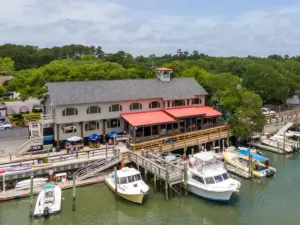
Oyster Landing is the largest and best-equipped public ramp in the area, and the courtesy docks make getting into a kayak considerably easier than sliding down a muddy bank. Launch, then turn away from the inlet mouth and work back into the creeks behind the MarshWalk. That direction matters. The inlet flushes fast near the mouth and there’s no reason for a first trip to go anywhere near it.
From the water you’ll get the view of the MarshWalk that nobody standing on the boardwalk gets — the restaurants on their pilings from the back side, the shrimp boats, and the low green wall of Drunken Jack’s Island across the channel. Meander the creeks, come back the way you came, done in an hour.
What you’ll see: Great blue herons and snowy egrets working the mud edges, fiddler crabs by the thousand on the banks as the water drops, oyster rakes surfacing at lower tide, ospreys overhead. Dolphins work the channel and creek mouths and turn up here often enough that it’s worth keeping your head up.
What to watch: Boat traffic. Oyster Landing gets genuinely crowded on summer weekends — arrive before 8 a.m. if you can, both for the parking and for the water. Kayaks sit low and are hard for a center console to pick out. Hug the marsh edge, wear something bright, and cross open channel deliberately rather than drifting across it.
2. Alston Creek Out-and-Back from Morse Park
Launch: Morse Park Landing hand launch Distance: ~2.5 to 3 miles round trip Time on water: 1.5 to 2 hours Difficulty: Beginner paddling, intermediate planning Tide window: HW−2 to HW+1 — this one is not negotiable Bail-out: Limited. It’s an out-and-back up a creek; you return the way you came Parking: Street only
This is the paddle to do if you want the marsh to yourself, and it comes with a condition attached.
The hand launch at Morse Park is a primitive put-in rather than a ramp — kayaks and canoes, no trailers — which is exactly why it stays quiet while Oyster Landing fills up half a mile away. Head up Alston Creek and inside of ten minutes the built world drops away. Spartina on both sides, water like a held breath, and on a still morning the only sounds are birds and your own paddle.
The condition: Alston Creek drains to mud. At the bottom of the tide, meaningful stretches of it are pluff mud rather than water. This isn’t a hazard so much as a humiliation — you don’t drown in pluff mud, you just end up standing in it, sinking to your shins, dragging a kayak toward water that keeps retreating. Launch two hours before high water, turn around at high water, and be back at the truck within an hour of the turn.
Done inside that window it’s the best short paddle in Murrells Inlet. Done outside it, it’s a story you tell later.
What you’ll see: Wading birds at close range, because the creek is narrow and they’re used to it. Clapper rails you’ll hear before you see. Marsh wrens. Rays gliding under the boat in clear water. At the right stage you’ll pass exposed oyster beds close enough to hear them tick.
What to watch: The mud, and the clock. Set an alarm on your phone for your turnaround time and actually turn around when it goes off. Also: don’t step out onto the marsh bank to stretch your legs. There’s rarely solid footing away from an established launch, and oyster shell will cut through cheap water shoes.
3. Garden City Creeks Toward the Inlet
Launch: Garden City Boat Ramp Distance: 4 to 5 miles Time on water: 2.5 to 3.5 hours Difficulty: Intermediate Tide window: HW−3 to HW+2, launching on the last of the incoming Bail-out: Poor in the middle third — commit to the route or don’t start it Parking: Small paved lot, free
The step up. This is the first route on the list where you need to have thought about the tide before you left the house, and where “I’ll just turn around” stops being a complete plan.
The Garden City ramp is the closest public launch to Surfside Beach and it puts you into Main Creek and the marsh system running behind the strand. The paddling is genuinely lovely — wide open marsh, big sky, the backs of the beach houses shrinking behind you — and it’s a landscape most visitors to Garden City never see, because they’re eighty yards away on the sand looking the other direction.
Time it so you launch on the last of the flood, work toward the inlet, and let the beginning of the ebb carry you home. Or reverse it. What you do not want is to be at the far end of the route with three hours of hard current against you and a creek that’s shoaling under your hull.
Do not push all the way to the mouth. The inlet proper is where the current concentrates, and this route is a marsh route that happens to point in that direction. Turn when the water starts to feel like it has its own opinion.
What you’ll see: Dolphins are frequently reported in the inlet near this ramp. Big populations of wading birds, terns and skimmers working the shallows, and in the warmer months rays and small sharks in the skinny water — which are exactly as uninterested in you as you’d hope. In fall the mullet come through in numbers and everything with teeth follows them.
What to watch: The ramp area shoals at low tide, so your return window is real. Motorboat traffic is moderate and concentrated near the ramp and the main channel.
4. Wacca Wache South on the Waccamaw
Launch: Wacca Wache Landing Distance: 4 to 6 miles, and you choose Time on water: 2.5 to 4 hours Difficulty: Intermediate Tide window: Flexible — tidal influence is present but gentler here. Wind and boat traffic matter more than tide stage Bail-out: Linear route, limited landing spots Parking: Moderate, free
Everything else on this list is salt marsh. This is not.
Wacca Wache puts you on the Waccamaw River and the Intracoastal Waterway, and the landscape changes completely: blackwater instead of green-brown tidal creek, bald cypress and tupelo hung with Spanish moss instead of spartina, shade instead of unrelenting sun. The water is dark from tannins leached out of the swamp — it’s clean, it just looks like strong tea.
Because the river corridor is tree-lined, this is your bad-wind day route. When it’s blowing twenty across the open marsh and everything else on this list has turned into work, the Waccamaw is still paddleable. It’s also the coolest route in August, by a wide margin, for the simple reason that there’s shade.
What you’ll see: Osprey nests on the channel markers, bald eagles with real regularity, otters, sliders stacked on every fallen log, and alligators on the banks in warm weather. Cypress knees. It looks and feels like a different state from the inlet, twenty minutes away.
What to watch: This is the Intracoastal Waterway, which means barges and large motor vessels. Paddle single file, stay to the right side of the channel, and give way early rather than late — a barge cannot maneuver around you and won’t. If one is coming, get to the edge and stay there until the wake has passed. Cell service is patchy and creek junctions off the main river genuinely do look alike, so download an offline map before you launch.
5. The Jetty Run
Launch: Oyster Landing Distance: 5 to 6 miles round trip Time on water: 3 to 4 hours including time ashore Difficulty: Advanced Tide window: Narrow — plan to be at the mouth within an hour of slack water Bail-out: None once you’re past the last creek junction Parking: 112 free spaces
The payoff route, with the biggest asterisk on this page.
From Oyster Landing you follow the main channel out toward the inlet mouth and the rock jetty, where there’s a sandbar you can pull up on and a stretch of near-private beach connected to the jetty itself. It’s the trip everyone wants to have done. Local outfitters build half-day tours around it and there’s a reason.
Here’s the asterisk. The inlet mouth is the one place in Murrells Inlet where the water can genuinely overpower a recreational paddler. The inlet flushes hard, the current concentrates as the channel narrows, and an ebb tide at the mouth pushes toward open ocean. The right plan is to be at the jetty near slack water, accept working against a gentle current on one leg of the trip, and never be sitting at the mouth during peak flow. Add wind against tide and you get standing chop that a sit-on-top rental is not built for.
If reading that paragraph gave you a clear picture of how you’d time the day, go. If it didn’t, do this one with a guide the first time — several local operators run exactly this trip, and what that costs is less than most people assume. See our rentals and operators page for who’s running what.
What you’ll see: The best wildlife of any route here. Far more shorebirds than the interior creeks — terns, skimmers, oystercatchers, plovers — plus your best odds of dolphins working the mouth and sea turtles between roughly May and October. The walk out along the jetty is worth the paddle on its own.
What to watch: Everything above, plus the fact that this is the busiest boat channel in the inlet. Bring water and food; three to four hours in open sun with no shade takes more out of you than you expect.
Quick comparison
| Route | Distance | Difficulty | Tide window | Bail-out |
|---|---|---|---|---|
| Oyster Landing marsh loop | ~2 mi | Beginner | HW−2 to HW+2 | Excellent |
| Alston Creek out-and-back | ~2.5–3 mi | Beginner (strict timing) | HW−2 to HW+1 | Limited |
| Garden City creeks | 4–5 mi | Intermediate | HW−3 to HW+2 | Poor mid-route |
| Wacca Wache / Waccamaw | 4–6 mi | Intermediate | Flexible | Limited |
| The jetty run | 5–6 mi | Advanced | Near slack only | None |
Which one should you pick?
First time in a kayak, ever: Oyster Landing marsh loop. Nothing else is close.
With kids: Oyster Landing, mid-morning, and keep it under an hour.
You want quiet and you can plan around a clock: Alston Creek.
It’s blowing hard, or it’s 96 degrees: Wacca Wache. Trees block wind and make shade.
You’ve paddled a fair bit and want distance: Garden City creeks.
You want the postcard: The jetty run, with a guide the first time.
If you’re fishing rather than sightseeing, the routing logic changes — you’re planning around where the fish are on a given tide stage rather than around the paddling. Our inshore species guide covers where redfish, flounder, and trout hold and on which tide.
Frequently asked questions
Are there marked kayak trails in Murrells Inlet?
Not in the sense of a blazed, signposted trail system. The creeks are the trail, and the routes above are the ones locals actually paddle. That’s why the tide window on each one matters — there’s no marker telling you the creek ahead is about to become mud.
What’s the longest paddle you can do here in one day?
Considerably more than anything on this list. Experienced paddlers link the inlet creeks or run long stretches of the Waccamaw. These five are the routes that work for the great majority of people, on rental equipment, in half a day.
Can I do these on a paddleboard?
The Oyster Landing loop and Alston Creek, yes, on a calm morning at the right tide. Garden City and the Waccamaw, only if you’re a strong and experienced boarder — wind exposure and boat wake are the issues. The jetty run, no.
Do I need my own kayak?
No. Local operators rent by the hour and half-day, and every route here can be done on a standard sit-on-top rental. See our rentals page for who rents what and where.
How do I know if I’ve picked the wrong tide?
The honest test: if you’re paddling out and it feels effortless, ask why. Current helping you on the way out is current fighting you on the way back. That’s the mistake almost every visitor makes here, and it’s the whole reason these routes list a window instead of just a distance.
What if I want somebody to just plan the day for me?
That’s what we’re here for. Tell us where you’re staying, how experienced you are, and what you want to see, and we’ll match you to the launch, the tide window, and the operator that fit. Plan my trip →
Conditions change. Creeks shoal, ramps close for repairs, and a big storm can rearrange a sandbar overnight. Check the current tide chart and the marine forecast before every trip, and see our full launch site guide for GPS coordinates, parking details, and access notes on all thirteen public launches from Surfside Beach to Georgetown.